Tag Archives: Wind

Center of Innovation – Energy

Where’s Waldo? And where’s the state renewable energy strategy for Georgia, or for the southeast, or for just south Georgia? Valdosta-Lowndes County Industrial Authority (VLCIA) Project Manager Allan Ricketts found another candidate.
“Forests Dominate Georgia’s Land Use”
That’s the title of slide 10 of 21 in Center of Innovation – Energy (CIE) by Jill Stuckey, Director. Actually, massively pesticided planted pines dominate south Georgia’s land use; not the same as actual forests with species diversity and diverse ages of trees. The same CIE slide equates
Georgia Forestry = Biomass Energy
That is what the state government seems to want it to be.

Back on slide 9, solar is defined as a southwestern regional energy source; nevermind that the solar map on that page shows Georgia with the same insolation as most of Texas (more on that later). And wind is defined as a central U.S. regional strength, nevermind that even Georgia Power has started exploring the possibility of wind off the Georgia coast.

I get it that Georgia has trees and forestry is a big industry in Georgia. I’m a tree farmer myself. I’d love to be convinced that biomass from trees is one good way to go. But at what costs? And compared to what? Continue reading
State Energy Strategy of Georgia

Among the questions local citizens asked the Valdosta-Lowndes County Industrial Authority (VLCIA) was where is the south Georgia, state, or southeast U.S. renewable energy strategy? VLCIA Project Manager Allan Ricketts looked, and he couldn’t find it, either. He did find this list of “renewable energy strategy” hits from a GEFA search. At least one of those links points us to http://www.georgiaenergyplan.org/, which now gets us
Are you interested in buying this domain name?
The state has apparently abandoned that domain. Is that an indication of how seriously Georgia takes renewable energy?

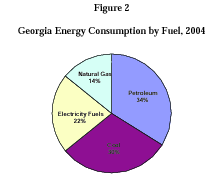
Here’s something that looks promising: State Energy Strategy for Georgia (SESG), December 14, 2006, Governor’s Energy Policy Council, GEFA. It says it’s an energy strategy, but it’s mostly about transportation of existing fuels such as natural gas. Towards the end of the document in Figure 2 (shown above) the SESG illustrates the pit we’re in: about a third of Georgia’s energy comes from coal, another third from petroleum, a sixth from natural gas, and so little from renewable sources they apparently weren’t worth putting on the pie chart.

The SESG does contain this: Continue reading

Highland Renewable Energy Strategy

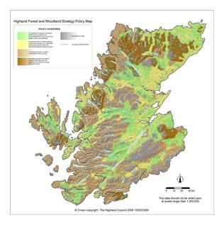
Previously writing about biomass and carbon dioxide I said I’d supply an example of the sort of thing I’m looking for as a regional analysis for renewable energy, including biomass, solar, wind, wave, tides, and others. Here it is: the Highland Renewable Energy Strategy approved by the Highland Council at its 4 May 2006 meeting. It’s a 58 page document about renewable energy strategy and planning guidelines, considering numerous types of renewable energy, pros and cons of each, power distribution, effects on environment, protected areas, etc., illustrated copiously with detailed maps. And updated: Continue reading

Effects of proposed biomass plants in Massachusetts

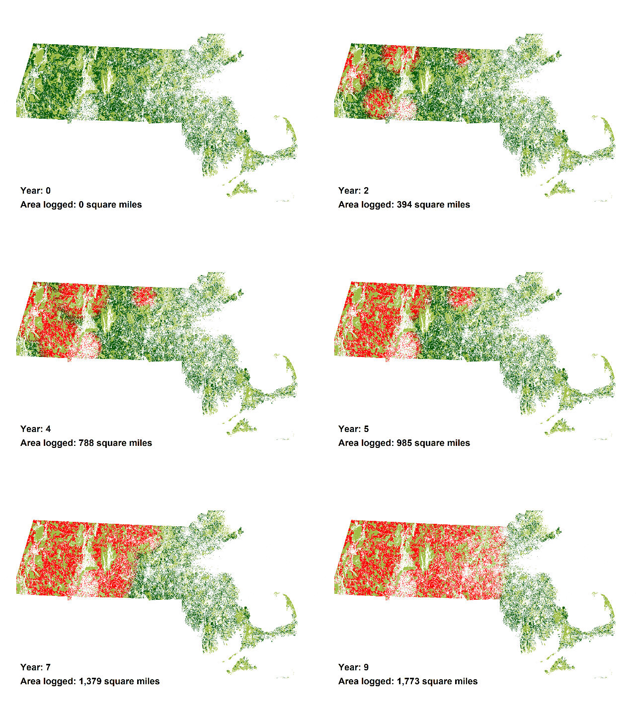
Very interesting projection of Massachusetts Forest Impacts if Proposed Biomass Incinerators Are Allowed by Chris Matera, P.E., and Ellen Moyer, Ph.D, P.E., with GIS analysis and programming by Gordon Green:

The animations add the demand for wood for 5 proposed biomass incinerators in Massachusetts to the current wood demand, which is mainly for lumber and cord wood. The animations demonstrate the land area in western and central Massachusetts that would be required to be logged to satisfy the total demand for these 5 plants which would add only about 1 percent to Massachusetts’ electrical generating capacity (see calculations below).

Quite a price for such a small percentage of electricity generation. Solar, wind, and wave could generate far more electricity, even in far northern Massachusetts.

And the animation above is a conservative projection. Follow the link for

…the extreme case where all forested land in central and western Massachusetts would be made available for biomass cutting – including rare species habitat, scenic landscapes, public “protected” land, and other protected open space. In this case, all forested land in central and western Massachusetts would be logged in only 16 years.

In Georgia, that would include places like Reed Bingham State Park.

-jsq