Tag Archives: Ashley Tye

County response to 10 inches of rain —Ashley Tye @ LCC 2013-02-26

Emergency Services Director Ashley Tye spoke about Local weather conditions at the 26 Febuary 2013 Lowndes County Commission meeting. He said the Withlacoochee River at Skipper Bridge Road was expected to crest at 20 feet within hours. He didn’t expect Valdosta’s Withlacoochee Wastewater Treatment Plant to flood.

He said most of the rain fell to the west of Valdosta, so the Little River actually absorbed more water than the Withlacoochee this time. Only Shiloh Road and a few other roads were closed.

The boat ramps at Langdale Park were closed in conjunction with Parks and Rec.

A few schools were closed, but all expected to reopen the next day.

Commissioner Demarcus Marshall asked Continue reading

Lowndes County continuing funding for USGS HWY 122 Stream Gauge —Ashley Tye @ LCC 2012-09-10

Lowndes County Emergency Management Director Ashley Tye reported to the Lowndes County Commission at their Work Session yesterday morning that after the floods of 2009, Lowndes County negotiated with USGS to put a stream level monitor on the Withlacoochee Little River at the GA 122 bridge, and the county typically renews that funding once a year. We shall see whether they approve that this evening.

Here's the video:

Lowndes County continuing funding for USGS HWY 122 Stream Gauge —Ashley Tye
Work Session, Lowndes County Commission (LCC),
Video by Gretchen Quarterman for Lowndes Area Knowledge Exchange (LAKE), Valdosta, Lowndes County, Georgia, 10 September 2012.

-jsq

TS Debbie and south Georgia extreme drought —Ashley Tye @ LCC 2012-06-25

Lowndes County Emergency Management Agency Director Ashley Tye correctly predicted no tornadoes and quite a bit of rain for when Tropical Storm Debbie made landfall. He also mentioned our chronic drought, and Commissioner Richard Raines was surprised about that.

Raines asked:

What kind of conditions would it take for us, because you and I talked a couple of weeks ago, and I was I was surprised when you said that. I guess there’s a difference between drought and extreme drought. What kind of rain conditions would we need to get out of that, I guess in terms of inches, for the water table….

Tye answered:

For them to officially declare us out of the drought, the latest numbers I’ve seen were about 15 inches over the next 30 days, or over the next 3 months, it would have to be like 25 to 30 inches. So we still need a lot of rain. But every little bit is going to help. With the rain we’ve got recently we’re better off than we were, but we’re still technically classifed as in extreme drought.

Here’s the video:

TS Debbie and south Georgia extreme drought —Ashley Tye
Work Session, Lowndes County Commission (LCC),
Video by Gretchen Quarterman for Lowndes Area Knowledge Exchange (LAKE), Valdosta, Lowndes County, Georgia, 25 June 2012.

Readers of this blog know we were already in drought more than a year ago. According to U.S. Drought Monitor, we’ve been in a protracted extreme drought since then. According to USGS, our groundwater levels are all red, as in extremely low. Extremely low as in at historically low levels, as in they’ve hardly ever, if ever, been this low.

-jsq

The Lowndes-Lanier County EF3 Tornado —NOAA

The tornado was an F2 in Lowndes County and an F3 in Lanier. It went west to east, wrote the NWS in Tallahassee. The pictures we posted that day were apparently where it first touched down, and even then it ripped limbs off of trees and broke some off and threw them.

According to the National Weather Service Weather Forecast Office in Tallahasse, Severe Weather & Flooding Event of March 3, 2012; Lowndes-Lanier Co. EF3 Tornado,

The most significant damage of the severe weather event in south Georgia and north Florida was caused by a tornado that moved from just northwest of Moody Air Force Base to near Lakeland, Georgia. The damage was assessed by a survey team from the National Weather Service in Tallahassee. Most of the damage was consistent with an EF1 or EF2 tornado on the Enhanced Fujita Scale. However, the most severe damage — near Boyette Road and Highway 122 — was consistent with an EF3 rating on the Enhanced Fujita Scale. Maximum wind speeds were estimated to be around 140 mph at that location.
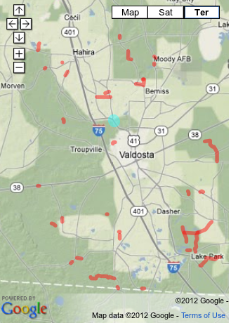
As you can see by NOAA’s map, the tornado was an EF0, EF1, and EF2 while it was in Lowndes County, (as Ashley Tye told the Lowndes County Commission this morning), rising to an EF3 in Lanier County, peaking at 140 mph winds.


View Larger Map

-jsq

Hazard mitigation public hearing 6PM today

Found on the Lowndes County government website:
Hazard Mitigation Public Hearing (10/17/2011)
PUBLIC HEARING ON
HAZARD MITIGATION
MONDAY, OCTOBER 17, 2011
6:00 P.M.
ADMINISTRATION BUILDING
327 N. ASHLEY STREET
COMMISSION CHAMBERS – 2ND FLOOR
For more information please contact EMA Director, Ashley Tye, at 671-2790.
SO I called Ashley Tye, who said: Continue reading