The
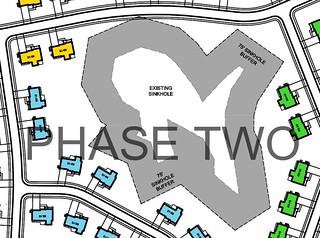
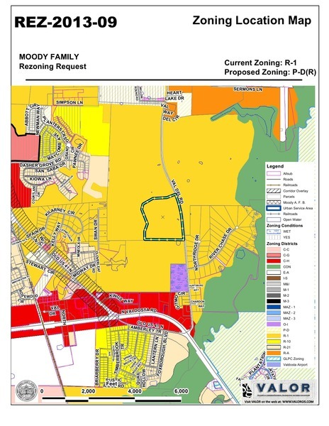
Moody Family Housing just rezoned is in a recharge zone for
 our drinking water supply, the Floridan Aquifer.
What will keep runoff from this subdivision from feeding through
the wetlands and sinkhole into the aquifer?
Should we depend on county engineering, which never put in
the traffic calming measures
required for nearby Nelson Hill, or other county staff,
who gave waivers for other required items there, or just didn’t
require them to be implemented?
What assurances can we get from our county government that Moody Family
Housing won’t pollute our drinking water?
our drinking water supply, the Floridan Aquifer.
What will keep runoff from this subdivision from feeding through
the wetlands and sinkhole into the aquifer?
Should we depend on county engineering, which never put in
the traffic calming measures
required for nearby Nelson Hill, or other county staff,
who gave waivers for other required items there, or just didn’t
require them to be implemented?
What assurances can we get from our county government that Moody Family
Housing won’t pollute our drinking water?
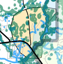
 The above map is a detail from
Lowndes County’s own
Water Resource Protection Districts
Ordinance (WRPDO) overlay Map.
Here’s an even more detailed view courtesy
VALOR GIS (turn on Streams and Waterbodies, NWI Wetlands, Muncipal Boundaries, and Groundwater Rechard Areas): Continue reading
The above map is a detail from
Lowndes County’s own
Water Resource Protection Districts
Ordinance (WRPDO) overlay Map.
Here’s an even more detailed view courtesy
VALOR GIS (turn on Streams and Waterbodies, NWI Wetlands, Muncipal Boundaries, and Groundwater Rechard Areas): Continue reading