Watch out Albany Mall, Deerfield-Windsor School, Kerr Gardens Park and Pond,
Miller-Coors Albany Brewery, Pilot Travel Center and of course the Flint River at the US 82 bridge!
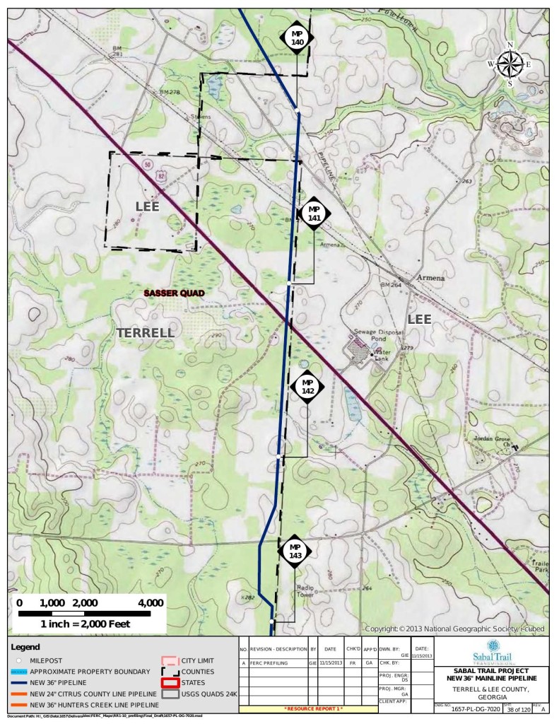
 If Sabal Trail’s mile point (MP) 141 is still on the Lee-Dougherty County
line just west of Armena, GA on US 82, then
Alternative 2 in
FERC’s recent instructions for Sabal Trail to “include analyses” would look very
much like
Alternative 1, plowing through the north edge of Albany, GA
and much of Dougherty County,
before heading on through Sylvester, Tifton, Adel, Hahira, Valdosta, Jennings, Lake City, Alachua, Gainesville, Ocala, Wildwood, past The Villages, to Ferndale, FL.
Alternative 2 extending along other pipeline and road rights-of-way from near MP 0 to approximately MP 141 (near Albany, Georgia), and then following Alternate 1 to the proposed endpoint.
Here’s MP 141 in the maps Sabal Trail sent to FERC in November 2013:
You can see that heads right past a mall, a school, a brewery, etc.:
Here’s a very rough map of the whole route of Alternative 2:
What say we call off the pipeline and deploy clean, safe, affordable solar power instead, for jobs, power, and lower electric bills right here where we need them? After all, Sabal Trail’s own figures show it would take half the land of that pipeline to produce just as much solar power.
-jsq
Short Link:


Pingback: Sabal Trail to move pipeline off Withlacoochee River in Florida? - WWALS Watershed Coalition